Google Adds 45 Degree Aerial Images to Maps


Highly rated gadgets
-
10.0
 FujiFilm X-T3
-
8.5
 Xiaomi Mi A2
-
9.1
 Apple iPhone XS Max
-
9.0
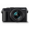 Panasonic LUMIX LX100 II
-
8.0
 BlackBerry Motion
-
9.0
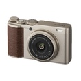 FujiFilm XF10
-
9.1
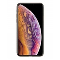 Apple iPhone XS
-
9.0
 Sony WH-1000XM3
-
10.0
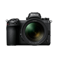 Nikon Z 7


Google has added a new view option to the online Google Maps service. When viewing select cities in satellite mode, you can now see things from a 45 degree angle. When zooming into an area »read more
More at: Maximum PC Add additional source